If you’re looking for a great nature walk, but aren’t sure where to go in the winter, check out these 4 unique trails across the metro from Take a Hike, KC.
With over 80 local hiking trail recommendations and 11,000 followers on social media, Take a Hike, KC has become one of Kansas City’s most popular trail guides. Girl Scout Lizzie Place started the Take a Hike, KC website to create a comprehensive guide to trails across Kansas City with the goal of making hiking destinations accessible to everyone.
In the winter, Take a Hike, KC recommends paved trails to protect dirt trails from changing weather conditions. If the ground is frozen solid, dirt trails are okay to use. Urban Trail Co tracks the status for many dirt trails and if they are open or closed for activities.
Enjoy these 4 winter walks with trail reviews from Take a Hike, KC.
1.Eagle’s View Trail at Smithville Lake – Smithville, MO
See the bald eagles at Eagle’s View trailhead at Smithville Lake. The trail is part gravel, part paved, and about 2 miles of a loop beside the lake and through the trees.
Located near 17201 Paradesian Rd., Smithville, MO, the trailhead is on the north side of Collins Rd. There is a small parking lot. To learn more, visit claycountymo.gov.
2.Cedar Niles Trail and Park – Olathe, KS
Johnson County Parks and Recreation’s Cedar Niles trail has three entrances. The scenic and quiet paved trail follows Cedar Creek through woods and fields, and crosses the creek several times. The trail runs almost 4 miles (not a loop) between the Clare Rd. and 135th St entrances. It also passes by the 119th St entrance. When the weather is dry, access the 4.5 mile Columbine dirt loop for hiking and biking at the Clare Rd. entrance.
Access the trail from three parking lots at 25117 W. 119th St, 12650 S. Clare Rd, and 25780 W. 135th St. in Olathe, KS. To learn more, visit jcprd.com.
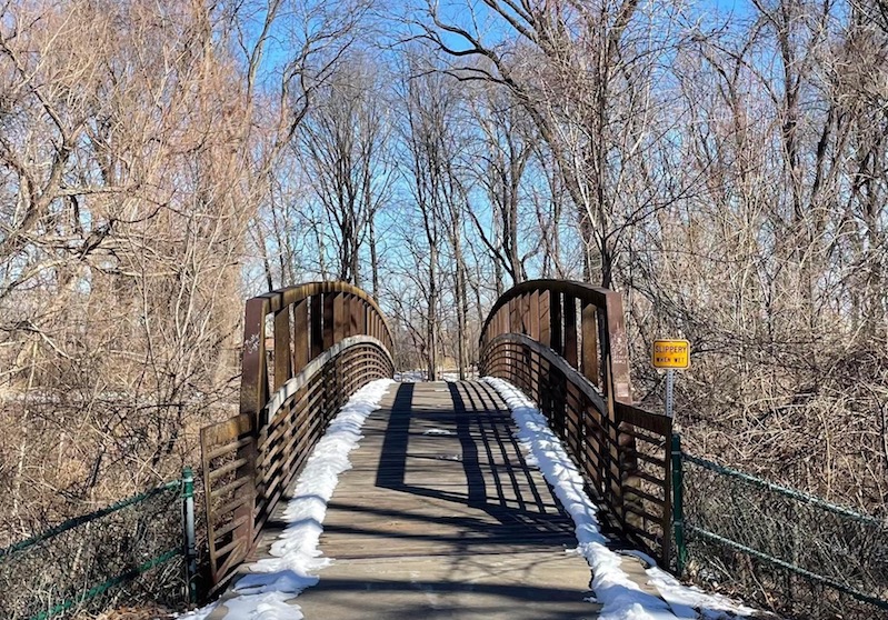
3.Gary L. Haller Trail – Johnson County, KS
Beginning just south of the Kansas River at I-435, Johnson County Parks and Recreation’s paved Gary L. Haller trail is gorgeous and well-maintained in every season. Even on the coldest day, there are people running, bicycling, and walking their dogs. The longer (13 miles+) trail is popular! Walk a half-mile north to Nelson Island. It’s not exactly an island, but there’s a fun curved bridge. There’s also a one-table picnic shelter there where you can look out over the Kaw (and see eagles here as well). The trail lies within the scenic Mill Creek Streamway Park. To learn more, visit jcprd.com.
The northernmost parking lot is at 19425 Wilder Dr., Shawnee, KS.
4.Roanoke Park Trails – Kansas City, MO
If you’ve never visited Kansas City Parks and Recreation’s Roanoke Park in midtown, make the trip! Steep limestone bluffs, wooded ravines and springs, a brick-laid section of road, and even its own mysterious and urban-legend-like cave, Roanoke Park is a pocket of natural delights in the city. Bound by 35th St. on the north, Valentine Rd. on the south, Wyoming St. on the west, and Southwest Blvd. on the east, the park seems much bigger than the 37 or so acres it contains. The steep staircases around the park are short, fun walks on a winter day. The playgrounds and amenities at Roanoke Park are great, too. To learn more, visit kcparks.org.
The park is located at 3601 Roanoke Road, Kansas City, MO 64111.
More on Take a Hike, KC
- Discover the top hiking trails across the metro including a printable PDF of 50 free hikes at takeahikekc.wordpress.com. Each trail review includes helpful information such as directions and access, wildlife and scenery, distances, if dogs are allowed, and other notes.
- Read Greenability’s story about Take a Hike, KC founder Lizzie Place.
- Earn the KCMO 6-District Hiker Patch when you hike a different trail in each of Kansas City, MO’s six council districts. This free patch program is in partnership with Kansas City Parks & Recreation.
Photos courtesy of Lizzie Place